Donut Team Hey everybody, we have a new tool to release today.
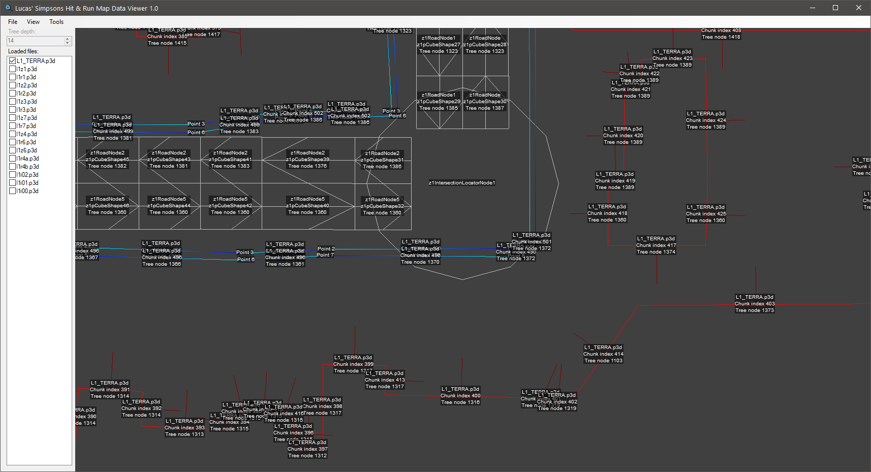
Introducing Lucas' Simpsons Hit & Run Map Data Viewer: a new tool to view roads, fences, intersects and more.
https://dl.dropboxuserconte
Hey everybody, we have a new tool to release today.
Introducing Lucas' Simpsons Hit & Run Map Data Viewer: a new tool to view roads, fences, intersects and more.
This tool enables you to easily do the following:
- View an entire level or individual zones.
- View the tree, fences, intersects, roads/intersections, ped paths, locators and triggers inside any loaded files.
- Easily identify specific unnamed chunks (like Fences or Intersects) by looking at their chunk indices to make manual edits to them with the Pure3D Editor.
- Getting an exact position and measuring between two points.
- Measuring distances along a road.
- Saving images of the map data.
Simply drag a TERRA file or a region in and take a look.
Download the tool
here.
Happy modding,
Donut Team
2,579 views ·
9 likes Sending vote...
Donut Team We released a new version (1.0.1) that fixes an issue where the tool did not work on different DPIs.
We released a new version (1.0.1) that fixes an issue where the tool did not work on different DPIs.
Donut Team We released another new version (1.0.2) with the following changes:
Fixed an issue where positions would be invalid if none of the loaded files (if there are any loaded) contained parts of a map.
F
We released another new version (1.0.2) with the following changes:
- Fixed an issue where positions would be invalid if none of the loaded files (if there are any loaded) contained parts of a map.
- Fixed an issue where the distance shown on the "Measure Roads" tool did not include the distance back to the cursor when clicking down.
- Made it so the program handles corrupted map files more gracefully by showing an informative dialog with an OK button that allows it to continue trying to load the file.
- Made it so you can press Ctrl+C on the main view to copy text. This text is context sensitive.
- The debug text in the upper left will be copied when on the "Pan" tool (if it's enabled).
- The position will be copied when on the "Position/Measure" tool when you're not measuring.
- The length of the line will be copied when on the "Position/Measure" tool when you are measuring.
- The length of the line will be copied when on the "Measure Roads" tool.
- Made it so you can select a file in the "Loaded files" list and press Ctrl+C to copy the full path to it.
Doctor Cpu quick question will this be of any use to map making?
quick question will this be of any use to map making?
Fluffy It's main purpose is to view data associated with maps. It's very helpful when modifying existing maps and when debugging new maps
It's main purpose is to view data associated with maps. It's very helpful when modifying existing maps and when debugging new maps